
Construction is driven and controlled by workers on the ground. So why would a construction company use GPS to guide operations and equipment? And why should you look for a company who does this?
GPS Construction Builds a Higher Quality Product
GPS adds another dimension of accuracy to our work by measuring elevation, as well as helping us track equipment to prevent liability issues. This is critical for grading foundations and monitoring a fleet of vehicles and/or heavy equipment.
That’s why the leading contractors in the business invest in GPS construction. It gives us additional perspectives for:
- Accuracy
- Stability
- Strength
- Security
- Project quality
Do you need GPS-guided precision grading for your project?
If you need your foundation or subgrade to be PERFECTLY LEVEL (or as close to it as possible), you definitely need a construction company that uses GPS-guided equipment. This may include:
- Parking lot paving projects
- Building construction
- Precision grading for other applications
Precision Grading
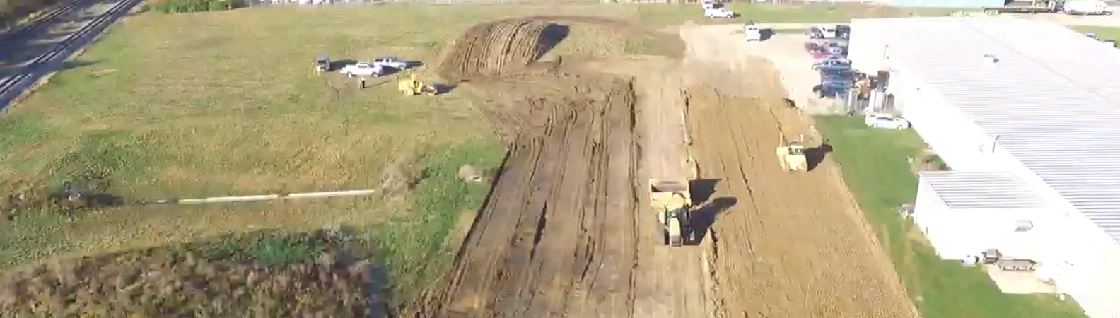
GPS grading in construction ensures a perfectly flat grade to the desired elevation. When attached to a bulldozer, a GPS unit measures both orientation and elevation. This allows the operator to create a perfectly flat foundation for your project.
GPS can also detect if there’s wheel or track slippage and alert the operator to adjust, helping to minimize time spent on re-doing imperfections.
Site Monitoring
GPS can also track the exact location and, in some cases, condition of the equipment. This protects you from liability concerns, and helps you track progress of your project.
GPS units with the right software can remotely monitor and electronically document:
- Mileage
- Engine hours
- Fuel and oil levels
- Exact location and activities on a construction site
It can also store info on earth materials, such as groundwater and rock formations, for use in utility construction or reporting.
Bring Precision to Your Construction Project with GPS
GPS construction equipment measures and analyzes your site by longitude, latitude, and elevation. This centralized system ensures your project meets all your expectations.
Want to see it in action? Check out one of our GPS-guided construction projects in this video: